InfraNZ
Explore Auckland's pipes, hydrants, outages, and environmental data in one layered map.
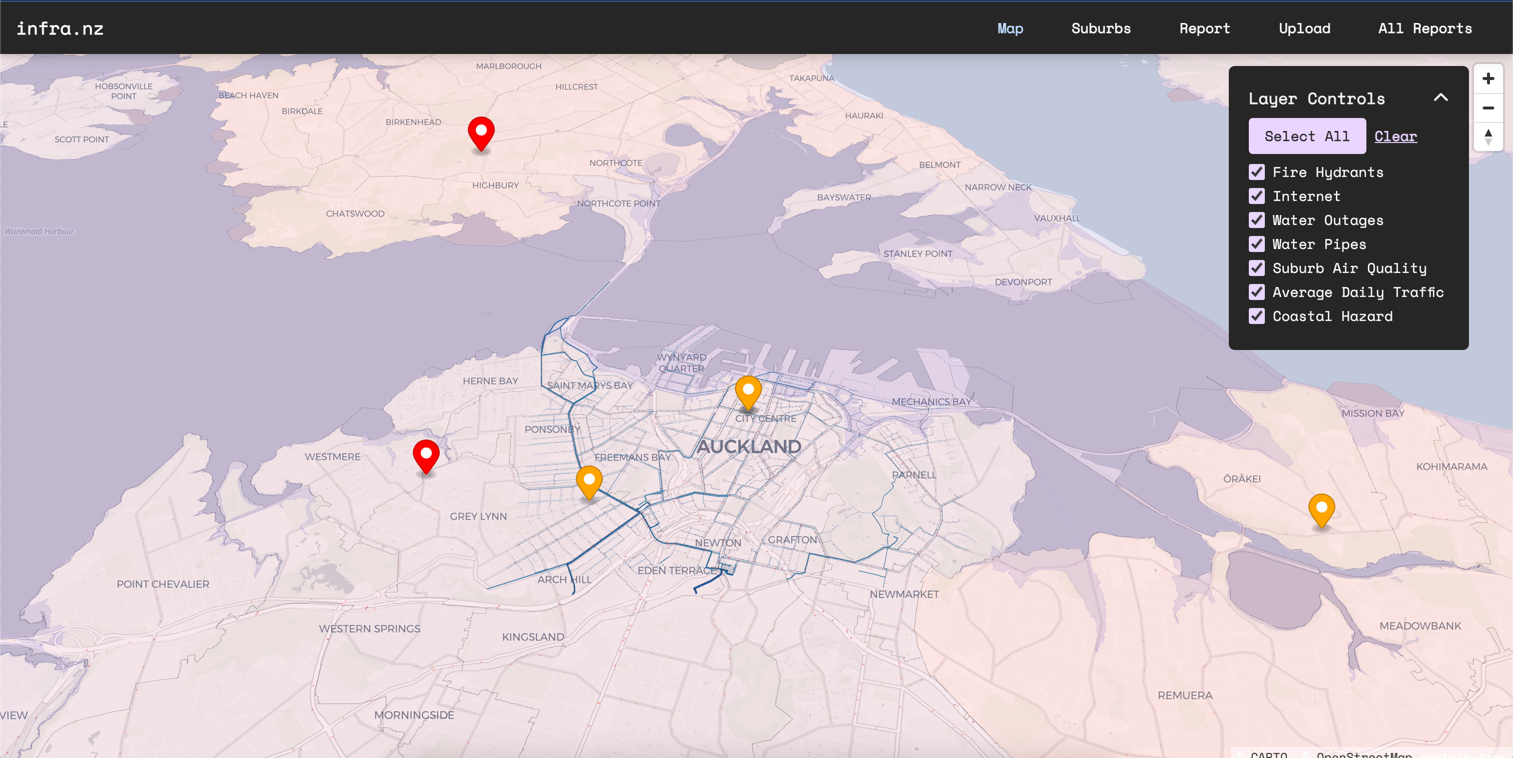
Built at GovHack 2023, InfraNZ brings public infrastructure and environmental datasets into a single Auckland map. Switch between water pipes, fire hydrants, outages, air quality, traffic, and coastal hazards to see their relationship to the city around them.
Our team built the proof of concept over a weekend. I worked on the map, its controls, data layers, and interface, while helping the team coordinate the wider demo. The original repository is called Tubes; it is the same InfraNZ project, rather than another app.
Highlights
- Seven independently controlled map layers
- 3D buildings and geographic overlays
- A GovHack team prototype using public data
In action
Look under the city
A map usually tells you where the roads and buildings are. Our GovHack idea was to put less visible infrastructure beside them: the pipes beneath the street, nearby hydrants, outages, and environmental conditions. Seeing those datasets together could make it easier to ask questions about how a neighbourhood works.
The larger proposal was a shared geographic record that professionals could improve over time. The weekend build demonstrated that idea through Auckland open data. It gave the team something concrete to show and discuss, while leaving the substantial work of validating records, managing permissions, and maintaining a dependable infrastructure service for a future product.
Layers that can be compared
The React interface combines a MapLibre basemap with Deck.gl overlays. Buildings are extruded into 3D, while pipes, markers, shaded suburbs, and other geographic features sit in the same coordinate system. Each layer has its own control, so a viewer can turn unrelated data off and compare the pieces that matter to a particular question.
The data needed different treatment before it reached the map. Large hydrant and water-pipe datasets were narrowed to central Auckland for the demonstration. Air-quality measurements were associated with suburb polygons, while traffic and coastal-hazard data could be loaded as geographic features. Connor built the Rust API for water and internet outages, alongside report storage.
A team demo in a weekend
I worked on the map and its interaction, including layer controls, popovers, rendering fixes, and styling. The original August 2023 commits preserve those changes alongside the rest of the team's work. I also tried to leave room for others to build their parts, helping with coordination and technical problems rather than taking every feature myself.
InfraNZ is a historical GovHack proof of concept. It shows how public datasets can become a visual explanation, and how much useful context a layered interface can reveal. The screenshot is from that original application. Tubes is the name of its team repository, so both names lead back to one project and one weekend of collaborative work.
